


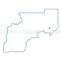
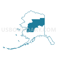
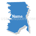
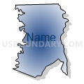
Circle Precinct, Yukon-Koyukuk Census Area, Alaska
About
Outline

Summary
| Unique Area Identifier | 523575 |
| Name | Circle Precinct |
| County | Yukon-Koyukuk Census Area |
| State | Alaska |
| Area (square miles) | 64.27 |
| Land Area (square miles) | 63.97 |
| Water Area (square miles) | 0.30 |
| % of Land Area | 99.53 |
| % of Water Area | 0.47 |
| Latitude of the Internal Point | 65.83895600 |
| Longtitude of the Internal Point | -144.17963790 |
Maps

Graphs
Select a template below for downloading or customizing gragh for Circle Precinct, Yukon-Koyukuk Census Area, Alaska


Neighbors
Neighoring Voting District (by Name) Neighboring Voting District on the Map
- Central Precinct (Part: Also See Part In Southeast Fairbanks Census Area), Yukon-Koyukuk Census Area, AK
- Fort Yukon Precinct, Yukon-Koyukuk Census Area, AK